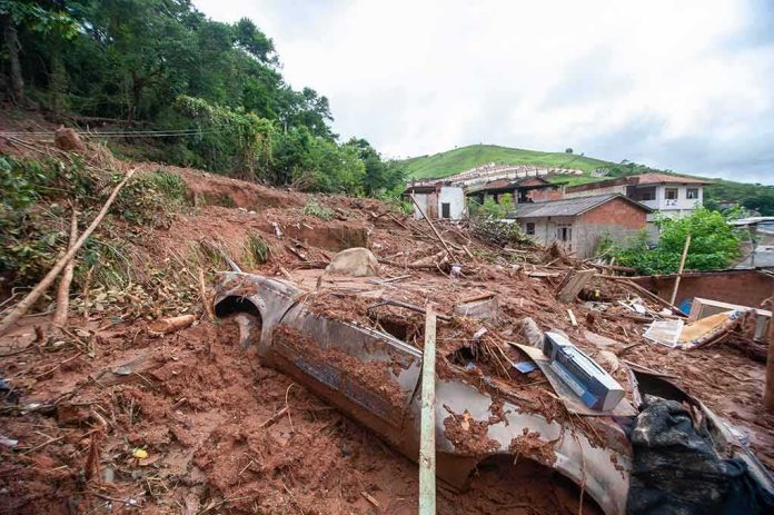
A collapsing mass of ice and rock roared into a Himalayan river, killing hundreds and leaving well over a thousand people unaccounted for across the Nepal–Tibet border region.
Story Snapshot
- Officials reported hundreds dead and more than 1,300 missing after a sudden flood and landslide.
- Nepal police and tourism officials gave body counts and missing-person figures that rose through the day.
- Scientists say a glacier and rock collapse likely triggered the deadly surge, not an earthquake.
- The disaster swept away villages, roads, bridges, and power sites along the Lhende River area.
What Happened Along the Nepal–Tibet Border
On August 26, a huge wall of mud, rock, and water sped down a river valley on the Nepal–Tibet border. The surge smashed villages, roads, and bridges, and hit power and project sites along the Lhende River area. Nepal police and other officials reported hundreds dead and more than 1,300 missing across the region as counts climbed through the evening. Reporters at the scene described debris-choked waterways and cars and trucks swept away as rescuers searched in dangerous conditions.
Nepal police reported recovering more than 150 bodies as the day progressed, and said the tally would change as teams reached new areas. The Nepal Tourist Board said over 400 tourists were missing, including a large number of foreign nationals, reflecting how popular trails and roads were hit at peak travel time. The wide range in the figures reflects the speed and scale of the disaster and the cross-border setting, where accounting is hard during the first days.
What Likely Triggered the Deadly Flood
Scientists and Nepal’s disaster managers pointed to a glacier and rock collapse that crashed onto the valley floor. That collapse likely sent a pulse of water, ice, and debris downstream at high speed. Early talk about a local earthquake faded after the United States Geological Survey said the seismic reading matched the collapse itself, not a separate quake. This fits a known pattern in the high Himalayas, where steep slopes and warming conditions can drive sudden, compound events.
Geologists cited satellite images showing a lower part of a glacier breaking off and dropping hundreds of meters into the river system. That kind of drop can create a shock wave through ice and sediment, turning a narrow valley into a funnel for destruction. Reuters and other outlets described officials calling the event a “glacier-inclusive flood,” a term used when ice, rock, and water combine into a fast, grinding flow that is hard for anyone in its path to outrun.
Why Counts Vary and What Comes Next
Rescue teams from Nepal’s police and army moved along the river corridor as weather and blocked roads allowed. Officials warned that totals would shift as teams reached remote hamlets and checked informal camps. The cross-border nature of the event adds complexity, since Nepal and China’s Tibet region report separately and on different timelines. These factors explain why reported deaths ranged widely during the first 24 to 48 hours, and why missing-person lists grew as families filed reports.
🚨🇳🇵 BREAKING — NEPAL: A catastrophic landslide and flash-flood disaster has left hundreds dead and more than 1,300 people missing, including dozens of Americans.
🌊 The disaster was initially linked to a 4.4-magnitude seismic event, but updated assessments indicate the flooding…
— Nova Intel (@intel_nova) August 27, 2026
This disaster highlights a shared global concern: fragile infrastructure near risky terrain can fail in seconds while authorities race to catch up. People across the political spectrum know that early warnings, honest data, and clear plans save lives. Clear, timely reporting from police and tourism officials helped the public understand the danger, even as numbers shifted. The next steps include restoring roads, checking dams and power sites, and publishing reconciled casualty rolls to bring families answers.